

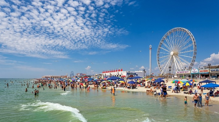
Jersey Shore beaches face mild surf, low rip-current risk and warm temperatures Wednesday, but morning showers and changing winds could still affect beach plans.
WEBDESK – NJNEWSLINE
A Mostly Calm Wednesday at the Jersey Shore
Wednesday, August 12, is expected to be a fairly comfortable day along the Jersey Shore, with no active beach advisories currently in place. The rip-current risk is low, and waves are expected to stay around 0 to 1 foot, making the ocean much calmer than it can be during rough summer conditions.
Temperatures near the coast should reach around 82 to 87 degrees, offering warm weather for beachgoers without the kind of intense heat that can make spending hours outside difficult.
Water temperatures, however, will vary considerably depending on where you are. Ocean temperatures are expected to range from roughly 68 to 84 degrees, so swimmers may notice a big difference from one beach to another.
Low Rip-Current Risk Brings Some Relief
For anyone planning to swim, the low rip-current risk is one of the better parts of Wednesday’s forecast.
Still, a low risk does not mean there is no risk at all. Swimmers should stay near lifeguards, pay attention to beach signs and follow any instructions from local officials.
The small waves, around 0 to 1 foot, should keep the surf relatively gentle. There is, however, a chance of showers during the morning, so visitors heading to the beach early may want to check the latest forecast before leaving.
Northeast Winds Could Make It Feel Breezier
The wind may be noticeable along some stretches of the coast.
Northeast winds are expected to blow around 6 to 12 mph, with gusts potentially reaching 18 mph. While those winds are not expected to create rough ocean conditions, they could make some beaches feel cooler or breezier than the temperature suggests.
The marine forecast puts seas at about 2 feet Wednesday, with winds around 5 to 10 knots. Waves should remain relatively small.
For anyone planning to spend most of the day on the sand, the breeze may be something to keep in mind when choosing a spot.
Morning Showers Could Disrupt Beach Plans
The main weather issue Wednesday is the possibility of morning showers.
That does not necessarily mean the entire day will be rainy. Instead, beachgoers may simply have to deal with a few interruptions early in the day.
Wednesday night looks quieter, with southwest winds around 5 to 10 knots and seas remaining close to 2 feet.
If you’re heading out early, checking the radar before leaving home is a good idea. A little flexibility could make it easier to avoid getting caught in a passing shower.
Don’t Forget the Strong UV Index
Even with showers possible in the morning, the sun remains something beachgoers should take seriously.
The UV index is expected to reach 7, which is considered high. Anyone spending several hours outdoors should use sunscreen, wear sunglasses and consider a hat or other protection from direct sunlight.
Drinking plenty of water is also important. Temperatures in the 80s can still feel quite warm when you’re sitting in the sun or staying active on the beach.
Tide Times Differ Along the Shore
Tide schedules can vary from one Jersey Shore community to another, so visitors should check the times for the specific beach they plan to visit.
At Sandy Hook, high tide is expected around 8:06 a.m., followed by low tide around 2:13 p.m. Another high tide is expected around 8:23 p.m.
At Long Branch, high tide is expected around 7:40 a.m., with low tide around 1:37 p.m. A second high tide should arrive around 7:57 p.m.
At Manasquan Inlet, high tide is forecast around 7:54 a.m., followed by low tide around 1:49 p.m. and another high tide around 8:11 p.m.
Further south, Seaside Heights should see high tide around 7:36 a.m., low tide around 1:41 p.m. and another high tide around 7:53 p.m.
These times can matter for people planning to fish, boat, swim or spend time near tidal areas.
The Rest of the Week Remains Relatively Calm
Thursday should remain fairly manageable along the coast. Winds are expected to come from the west at 5 to 10 knots before shifting southwest during the afternoon, with seas around 2 feet.
Friday brings another chance of morning showers. Winds should be from the north at 5 to 10 knots, with seas remaining close to 2 feet. Conditions could become breezier Friday night, when winds may reach 10 to 15 knots, with gusts up to 20 knots.
Saturday is expected to bring northeast winds of 5 to 10 knots and seas around 2 to 3 feet.
Sunday may be more unsettled. Southwest winds could strengthen during the afternoon, with seas reaching 2 to 3 feet. Sunday night could bring a more noticeable change, including southerly winds of 15 to 20 knots, seas of 2 to 4 feet and a chance of evening showers.
Thunderstorms could also produce stronger winds and higher seas.
What Beachgoers Should Know Wednesday
Overall, Wednesday looks like a fairly favorable beach day at the Jersey Shore, especially for people who prefer calm water and smaller waves.
The biggest things to keep in mind are the chance of morning showers, northeast winds and the high UV index. Tide times also vary depending on the location, so checking the schedule for your specific beach is worthwhile.
With no current beach advisories, low rip-current risk, small waves and temperatures in the 80s, Wednesday could be a good day to enjoy the coast.
Still, summer weather can change quickly. Checking the latest local forecast before heading out — particularly before getting into the water — remains the safest choice.
