

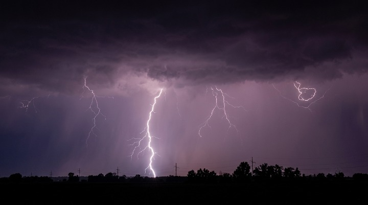
New Jersey faces dangerous thunderstorms today with life-threatening flash flooding, damaging winds, and possible tornadoes. Officials urge residents to avoid travel and monitor weather alerts closely.
WEBDESK – NJNEWSLINE
NJ Faces Dangerous Storms as Flash Flooding and Tornado Risk Return
New Jersey is bracing for another round of severe weather as meteorologists warn that powerful thunderstorms could bring life-threatening flash flooding, damaging winds and isolated tornadoes across much of the state.
Forecasters say multiple rounds of heavy rain are expected throughout the day, creating hazardous travel conditions and increasing the risk of flooding in low-lying neighborhoods. Residents are being urged to stay weather-aware and avoid unnecessary travel during periods of intense rainfall.
Flash Flooding Could Become Life-Threatening
The National Weather Service has placed much of New Jersey under a Flood Watch as slow-moving storm systems are expected to produce torrential rainfall.
Meteorologists warn that rainfall rates could exceed 2 to 3 inches per hour, quickly overwhelming storm drains, flooding streets and creating dangerous conditions in urban and flood-prone communities. Flash flooding may develop rapidly, especially during the afternoon and evening hours.
Strong Thunderstorms Could Turn Severe
In addition to heavy rain, today’s storms could produce several dangerous weather threats.
Forecasters say damaging wind gusts above 58 mph, frequent lightning, hail and isolated tornadoes remain possible as thunderstorms strengthen. Central and northern New Jersey are expected to experience the highest risk, although severe weather could affect communities across the state.
Travel Could Become Extremely Difficult
Officials are warning motorists to prepare for rapidly changing road conditions throughout the day.
Flash flooding can make roads impassable within minutes, while strong winds may knock down trees and power lines. Heavy rainfall could also reduce visibility, making driving especially dangerous during the strongest storms. Emergency officials continue reminding drivers never to attempt crossing flooded roadways.
Residents Urged to Monitor Weather Alerts
Emergency management agencies are encouraging residents to closely monitor the latest weather forecasts and official warnings.
People are advised to enable emergency alerts on their mobile devices, prepare emergency kits and have multiple ways to receive weather updates if power outages occur. Those living in flood-prone areas should be ready to move to higher ground if conditions deteriorate.
Power Outages and Localized Damage Possible
Utility companies are also preparing for possible service disruptions as severe storms move through the region.
Strong wind gusts may damage power infrastructure, while saturated ground could make trees more vulnerable to falling. Crews remain on standby to respond quickly if outages occur in affected neighborhoods.
Beach and Outdoor Activities May Be Disrupted
The unstable weather pattern could also affect outdoor events and recreational activities across New Jersey.
Officials advise beachgoers, hikers and park visitors to seek shelter immediately if thunderstorms develop. Lightning remains one of the most dangerous hazards during summer storms, even before heavy rain begins.
Stay Prepared Throughout the Day
Weather experts say conditions could change quickly as the storm system moves across the state.
Residents are encouraged to remain indoors during severe weather, avoid flooded areas and follow instructions issued by local authorities. While not every community will experience the most intense conditions, officials stress that everyone should remain prepared until the storms move out of the region.
