

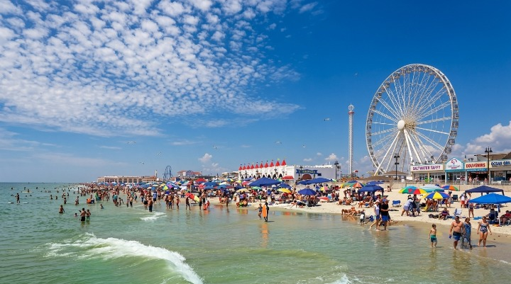
Jersey Shore beaches face another hot, humid Friday with temperatures near 91 degrees, very high UV levels, changing winds and thunderstorms threatening weekend plans.
WEBDESK – NJNEWSLINE
Hot and Humid Weather Returns to the Shore
Friday, August 7, is expected to bring another warm summer day to the Jersey Shore, with temperatures ranging from 82 to 91 degrees across coastal areas.
The heat will feel stronger because of humidity. A heat advisory remains in effect through 8 p.m. Saturday, and heat index values could climb as high as 103 degrees.
That combination could make extended time outdoors uncomfortable or potentially dangerous, particularly during the afternoon. People spending the day at the beach should drink plenty of water, take regular breaks and avoid staying in direct sunlight for long periods.
Those planning exercise, beach sports or other strenuous activities may want to schedule them during the morning or later in the evening, when conditions are typically more tolerable.
Low Rip Current Risk Brings Some Good News
There is at least one positive development for swimmers: the rip current risk is expected to remain low Friday.
Waves should generally remain between 1 and 3 feet, while winds are expected to start from the west at about 5 to 7 mph, with gusts near 12 mph.
Those conditions should provide relatively manageable ocean conditions for many beach visitors. However, a low rip current risk does not mean swimmers can ignore basic safety precautions.
People should stay close to lifeguarded areas and follow instructions from beach officials. Parents and guardians should also keep children within close reach, particularly as ocean conditions can change throughout the day.
Ocean Water Could Offer Relief From the Heat
Ocean temperatures are expected to vary significantly along the coast, ranging from roughly 63 to 82 degrees depending on the location.
The typical ocean temperature for this time of year is around 72 to 82 degrees, meaning some sections of the Shore could feel considerably cooler than others.
For visitors trying to escape the afternoon heat, getting into the ocean could provide welcome relief. Still, swimmers should remember that comfortable water temperatures do not replace normal water-safety precautions.
Checking local beach conditions before entering the water is especially important for families and less experienced swimmers.
Very High UV Levels Add to Friday’s Risks
Heat and humidity are not the only concerns for people spending Friday outside.
The UV Index is expected to reach 8, placing it in the very high category. Prolonged exposure to strong ultraviolet radiation can increase the risk of sunburn and other skin damage.
Beachgoers should apply sunscreen regularly and consider wearing sunglasses, hats and protective clothing. Spending some time under an umbrella or in another shaded area can also help reduce prolonged sun exposure.
Friday will offer a long period of daylight, with sunrise around 5:59 a.m. and sunset near 8:05 p.m. While that gives visitors plenty of time to enjoy the Shore, it also creates more opportunity for exposure to heat and strong sunlight.
Afternoon Winds Could Become Stronger
People heading onto the water should pay close attention to changing wind conditions later Friday.
The forecast calls for southwest winds around 5 to 10 knots, becoming southerly at approximately 10 to 15 knots during the afternoon. Gusts could reach 20 knots, while seas are expected to remain around 2 to 3 feet.
The increase could matter to boaters, anglers and others planning to travel farther from shore.
Patchy fog is also possible Friday morning, with visibility potentially dropping to between 1 and 3 nautical miles in some locations.
Showers and Thunderstorms May Develop
The weather could become unsettled later in the day.
There is a slight chance of showers and thunderstorms late Friday, with the threat increasing Friday night. Patchy fog could also return after midnight.
Thunderstorms can quickly change conditions along the beach and on the water. Visitors should keep an eye on weather alerts and be prepared to leave the shoreline if storms approach.
Boaters should take additional care because thunderstorms can bring stronger winds and rougher conditions than those shown in the general forecast.
Saturday Will Remain Hot
The heat will not disappear immediately.
Saturday is expected to continue the hot and humid pattern, with the heat advisory remaining in effect through Saturday evening. Marine conditions should stay relatively manageable, although winds will strengthen during the afternoon.
Southwest winds of around 5 to 10 knots are expected to become southerly at 10 to 15 knots, with gusts potentially reaching 20 knots. Seas should remain near 2 to 3 feet.
Anyone planning a full day at the beach this weekend should therefore prepare for continued heat rather than assuming cooler conditions will arrive immediately.
Sunday and Monday Could Bring Calmer Conditions
The forecast looks somewhat quieter after the weekend.
Sunday is expected to bring southwest winds of around 5 to 10 knots, with seas staying near 2 to 3 feet. Sunday night could see west winds in the same general range.
Monday appears even calmer, with southwest winds around 5 knots before shifting southerly during the afternoon. Seas are expected to remain near 2 feet.
Those conditions could be more favorable for boating and other outdoor activities early next week, although visitors should continue checking the latest forecast before heading out.
Tide Times Differ Along the Jersey Shore
Anyone planning activities around the water should also check tide times for their specific location because schedules vary significantly along the New Jersey coast.
At Sandy Hook, low tide is expected around 9 a.m., followed by high tide at approximately 3:18 p.m. Another low tide is expected around 10:22 p.m.
At Long Branch, low tide is forecast around 8:24 a.m., with high tide at 2:52 p.m. and another low tide at 9:46 p.m.
Further south, Atlantic City is expected to see low tide at about 8:26 a.m., high tide at 3:04 p.m. and another low tide around 9:50 p.m.
Cape May has a later schedule, with low tide around 9:31 a.m. and high tide near 4:13 p.m.
These differences can affect swimmers, anglers, families and anyone planning activities around the shoreline.
What Visitors Should Know Before Going
Friday can still be a classic Jersey Shore summer day, but visitors should not underestimate the combination of heat, humidity and very high UV exposure.
The low rip current risk and relatively small waves are encouraging for swimmers. However, the heat advisory and potential thunderstorms remain important concerns.
Boaters should watch for stronger afternoon winds, gusts, fog and sudden changes around thunderstorms. Beachgoers should stay hydrated, take breaks from direct sunlight and know the warning signs of heat exhaustion.
Overall, the Jersey Shore forecast offers plenty of summer weather but also several hazards worth preparing for. Checking the latest conditions before heading out can help visitors enjoy the coast while staying safer.
